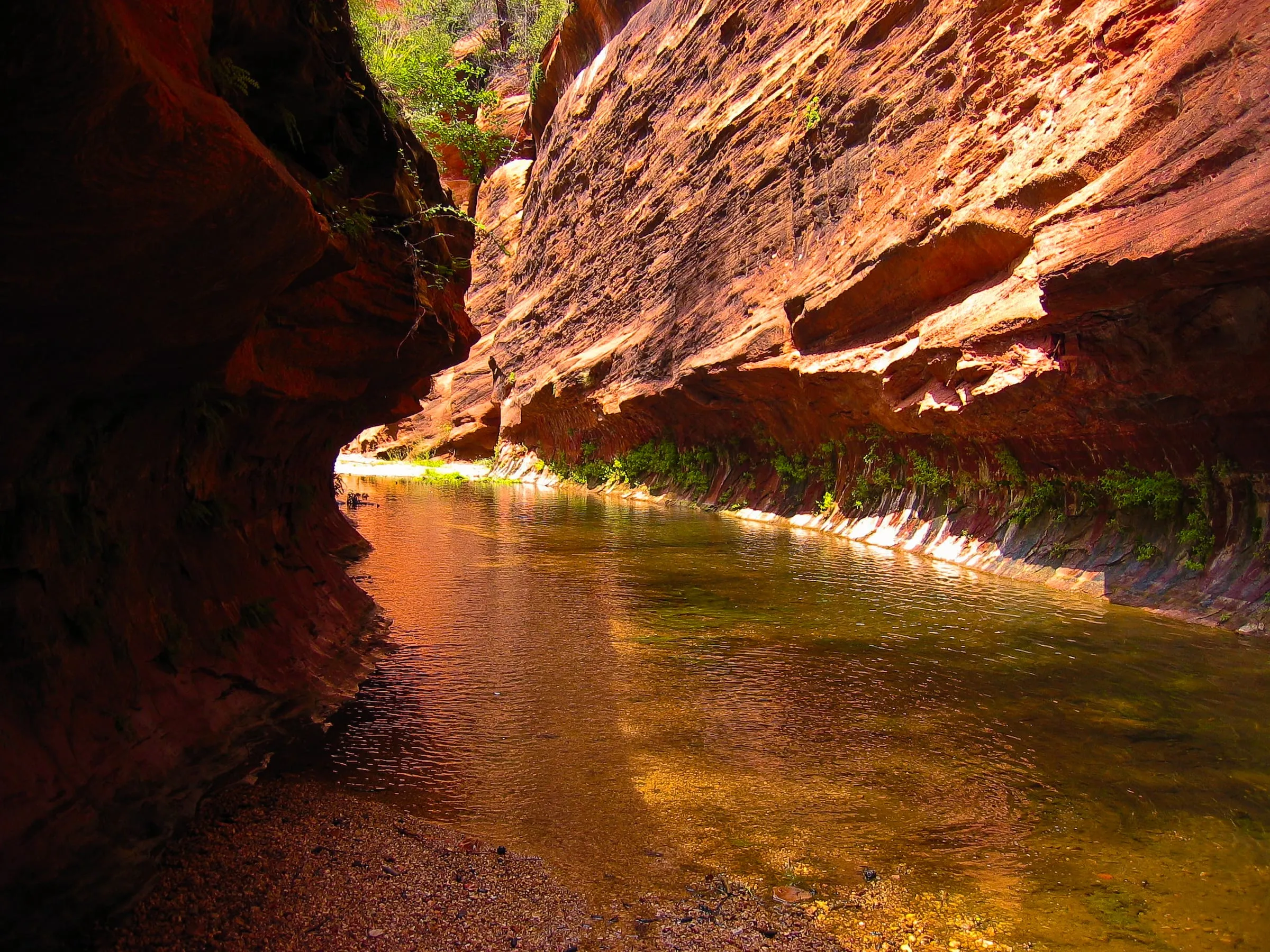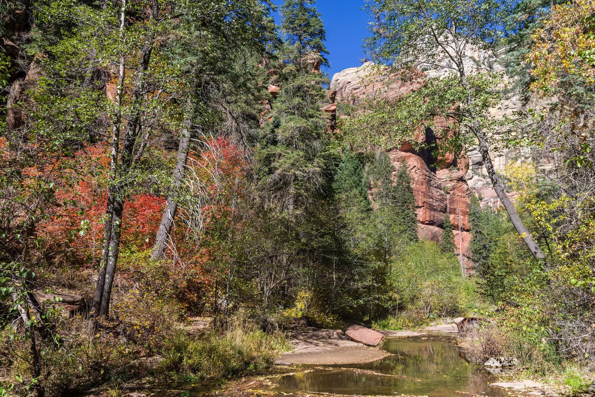
The West Fork of Oak Creek is a side canyon off Oak Creek Canyon, its trailhead 9.5 miles north of Sedona, and its trail is one of the most popular on the Coconino National Forest. It follows a small stream along the canyon floor under cliffs that tower above it, among maple trees that turn red and gold in the fall, and for its first 3 miles it is an easy walk that crosses the creek on stepping stones.
It is closed, and has been since 20 June 2026, under four Forest orders in turn. The latest shuts the whole trail inside the wilderness through 28 February 2027, and on 18 November 2026 its trailhead, the Call of the Canyon Picnic Site, was closed for the November flood as well. Below are the orders and their dates, what they close, the trailhead and its fee, the trail as it will be when it reopens, and where to hike in the meantime.
The closure, order by order
Four Forest orders bear on it:
- From 20 June 2026, the Pocket Fire closure order, 03-04-00-26-002, closed all Forest land, roads and trails in an area that took in Oak Creek Canyon above Casner Canyon, the West Fork among them, and every campground and day-use site in the canyon, with the Call of the Canyon Picnic Site, the West Fork’s trailhead, first on its list of sites affected. It was set to run “through September 30th at 2400 hours, unless rescinded”.
- From 31 July to 30 September 2026, order 03-04-00-26-005, the Oak Creek Temporary Area Closure, signed on 30 July, named the West Fork Trail itself, closing it, all Forest land within 100 feet of the West Fork, and the Forest land within 100 feet of Oak Creek from north of Call of the Canyon down the canyon to where the creek enters private land, with seven of the canyon’s picnic sites and campgrounds, Call of the Canyon among them, “due to the danger of flash flooding.”
- From 26 September to 31 October 2026, order 03-04-00-26-007, signed on 25 September, closed the West Fork itself.
- From 1 November 2026, order 03-04-00-26-09, signed on 22 October, carries the closure on: “This Order shall be in effect from November 1, 2026, at 12:00 am through February 28, 2027, at 11:59 p.m., unless rescinded.”
The two orders since 26 September give the same reason: “to protect public health and safety during and following precipitation events and resulting rockfall and flood debris hazards within the Oak Creek watershed affected by the Pocket Fire.” The current order was signed ten days before the flood of 1 November 2026, so the West Fork is not a flood closure, although the Forest’s flood alert, which starts on 2 November, lists the trail among the sites the flood affected.
The dates disagree in one place. The alert’s title reads “West Fork Temporary Area Closure — Extension to 2/27/27”, but the order itself, the alert’s own end date and the order’s map all give 28 February 2027. We go by the order, which runs through 11:59 p.m. on 28 February. “Unless rescinded” means the Forest can lift it sooner, and this order is itself an extension of the last one, so read its alert before you count on 1 March. Our flood closures page keeps the West Fork’s current status with the rest of the canyon’s.
What the order closes
The order forbids “Entering or being in an area” and “Being on a Trail” in what it calls the Described Area: “all National Forest System Lands within 100 feet of the West Fork of Oak Creek drainage” from Forest Road 231, at the head of the canyon, “easterly to the intersection of the Red Rock Secret Mountain Wilderness boundary”, and “the entirety of the West Fork (Trail #108) within the Red Rock Secret Mountain Wilderness.” That is the creek from the top of the canyon to the wilderness boundary near the trailhead, and every step of the trail inside the wilderness.
The trail’s own Forest page reads “Trail Partially Closed”, which suggests that some of it is open. The order’s map, Exhibit A, shows none: it draws the closed portion of the trail from the wilderness boundary, beside Call of the Canyon, west up the canyon, and marks no stretch open. The trailhead is shut besides. We call no part of the West Fork open. Do not try walking in from the highway either: ADOT’s release of 11 November 2026 said that “Parking along the highway is strictly prohibited.”
Breaking the order is a Class B misdemeanor, with a fine of up to $5,000 for a person, or up to six months in prison, or both. The only people exempt are those with a Forest Service permit for it, officers, rescue and firefighting crews, and contractors working for the Forest.
The trailhead: Call of the Canyon
The West Fork starts at the Call of the Canyon Picnic Site, which, in the Forest’s words, “pulls double duty as the trailhead for the West Fork Trail”. It is on the west side of State Route 89A, about halfway between mileposts 385 and 384, down a paved lane that runs behind a few creekside houses.
At 6:24 a.m. Arizona time on 18 November 2026, its Forest page read “Site Temporarily Closed” and “Temporarily closed due to severe flooding”, with no end date, and the Forest’s flood alert, last updated on 13 November, lists it beside the West Fork. So the order has to run out and the lot has to reopen before you can park for the trail. Its current status is on our flood closures page.
When it is open, these are its terms, from its Forest page:
| What | Call of the Canyon, when open |
|---|---|
| Day fee | $15 a vehicle, up to 5 people |
| On foot, by bicycle, off a bus, or each person beyond five | $4 a person |
| Passes | The Coconino Hospitality pass; not the Red Rock Pass or America the Beautiful |
| Hours | 7 a.m. to dusk from 1 April to 30 September; 8 a.m. to dusk from 1 October to 31 March |
| Vehicles | 24 feet long at most: no RVs, trailers, buses or other oversized vehicles |
| Facilities | Vault toilets and six picnic sites; no drinking water |
A concessionaire runs the site, and cash, checks and credit cards are all accepted. The Coconino Hospitality pass covers it and four other concessionaire sites, at $50 a year. Its weekly price is where the Forest’s pages disagree: $25 on the pass program page and on Call of the Canyon’s own page, both updated in 2026, and $20 on the West Fork trail’s page, last updated on 23 July 2025. Plan on $25. Which pass covers which lot around Sedona is on our Red Rock Pass and trailhead parking guide.
The paved lot fills quickly. In busy summer months the line for the gate backs up onto 89A, and the Forest asks drivers to say which pass they want and move on, rather than ask questions at the gate. Overnight parking is not allowed. Bring water: there is none to drink at the site.
The trail, for when it reopens
The trail starts at 5,325 feet and barely climbs: 52 feet in the first mile, 107 in two and 221 in three. The Forest calls it “an easy stroll, but you do have to cross the stream in a number of places”, usually on a few stepping stones or with a couple of steps in shallow water. It is marked and maintained for the first 3 miles, and the Forest allows 2 to 3 hours to walk that far and back. Many hikers go on beyond it.
Beyond 3 miles there is no clear trail. The route turns strenuous, and before long you are walking in the stream bed, deeper into the Red Rock-Secret Mountain Wilderness. The whole canyon is 14 miles, between Forest Road 231 at the top and 89A at the bottom, and the Forest’s guide to full trips is plain about what it takes:
- Start at the top. Overnight parking is not allowed at Call of the Canyon, so you park off Forest Road 231 and walk down, losing 1,178 feet over the 14 miles.
- Swim. At least three cold pools have to be swum, sometimes up to seven, between miles of boulder hopping. The Forest wants strong swimmers in good condition, a flotation aid such as a dry bag or a small raft, and preferably a wetsuit.
- Go in warm weather only, June through September, and never with floods in the forecast: the monsoon months, July and August, bring flash floods.
- Plan on a night out, and never go alone. There is little or no cell signal in the canyon.
- No fires. A fire, campfire or stove fire is prohibited in the canyon; only propane stoves are allowed.
Three rules hold for any visit. No bicycles: the canyon is designated wilderness, and in the Forest’s words, “Nothing mechanized is allowed on the trail, as this is in a designated Wilderness area. That means NO mountain bikes or bicycles.” Dogs must be on a leash, and you bag their waste and carry it out. Leave the flowers and the fall leaves where they are. The Forest may also close the trail at times of high fire danger, usually in late June.
When to go
Mornings and weekdays, says the Forest, better still in the off-season. Each season has its draw: songbirds migrating through in spring; in the fall, the canyon “ablaze with color”, red and gold leaves floating on clear pools; in winter, icicles hanging from the red rock overhangs and snow in the shady corners. Fall is the famous one, and the Forest says the picnic site is especially popular at the peak of the color. In 2026 the closures took in the whole season, and the summer before it.
If the order runs its course and is not extended, the trail’s first open day would be 1 March 2027, once Call of the Canyon has reopened too. Month by month, the weather and the crowds are on our best time to visit Sedona page.
Getting there
From Uptown Sedona the trailhead is about 10.4 miles up 89A, some 20 minutes without traffic; the Forest puts it 9.5 miles north of Sedona.
From Flagstaff the usual way is 89A down the canyon, and since the flood of 1 November 2026 that road had been closed on its switchbacks, for 3.5 miles from about milepost 387 to Oak Creek Vista at milepost 390. On 18 November 2026 it still was: on 11 November ADOT gave no estimated time for completion and said travel between Sedona and Flagstaff was restricted to SR 179 and I-17, and az511’s alert, updated on 16 November, gave no reopening date. While that holds, the trailhead is reached from Sedona only: from Flagstaff, I-17 south and SR 179 north through the Village of Oak Creek, about 58 miles and an hour and a quarter without traffic to Uptown, then up the canyon. The Forest’s trail page still puts the trailhead “17.5 miles south of Flagstaff”; that is by the closed road. The route is on our getting to Sedona page, and the road’s current state on the flood closures page.
Where to hike while it is closed
On the morning of 18 November 2026 the Forest’s own pages for the Devil’s Bridge, Cathedral Rock, Bell Rock Pathway, Soldier Pass, Boynton Canyon and Airport Loop trails carried no closure and no alert. Four of them have our own pages, with their lots and passes: Devil’s Bridge, Cathedral Rock, Bell Rock and Soldier Pass. Down the canyon on 89A, Slide Rock State Park is run by Arizona State Parks, with notices of its own.
To go with a guide, our guided hiking page compares Sedona’s private guided hikes and its night hikes. Whatever you do instead, Viator’s full list of what can be booked in Sedona is at the end of this page: check where each trip starts.
The photograph below shows the West Fork between its red sandstone walls, in August 2006.