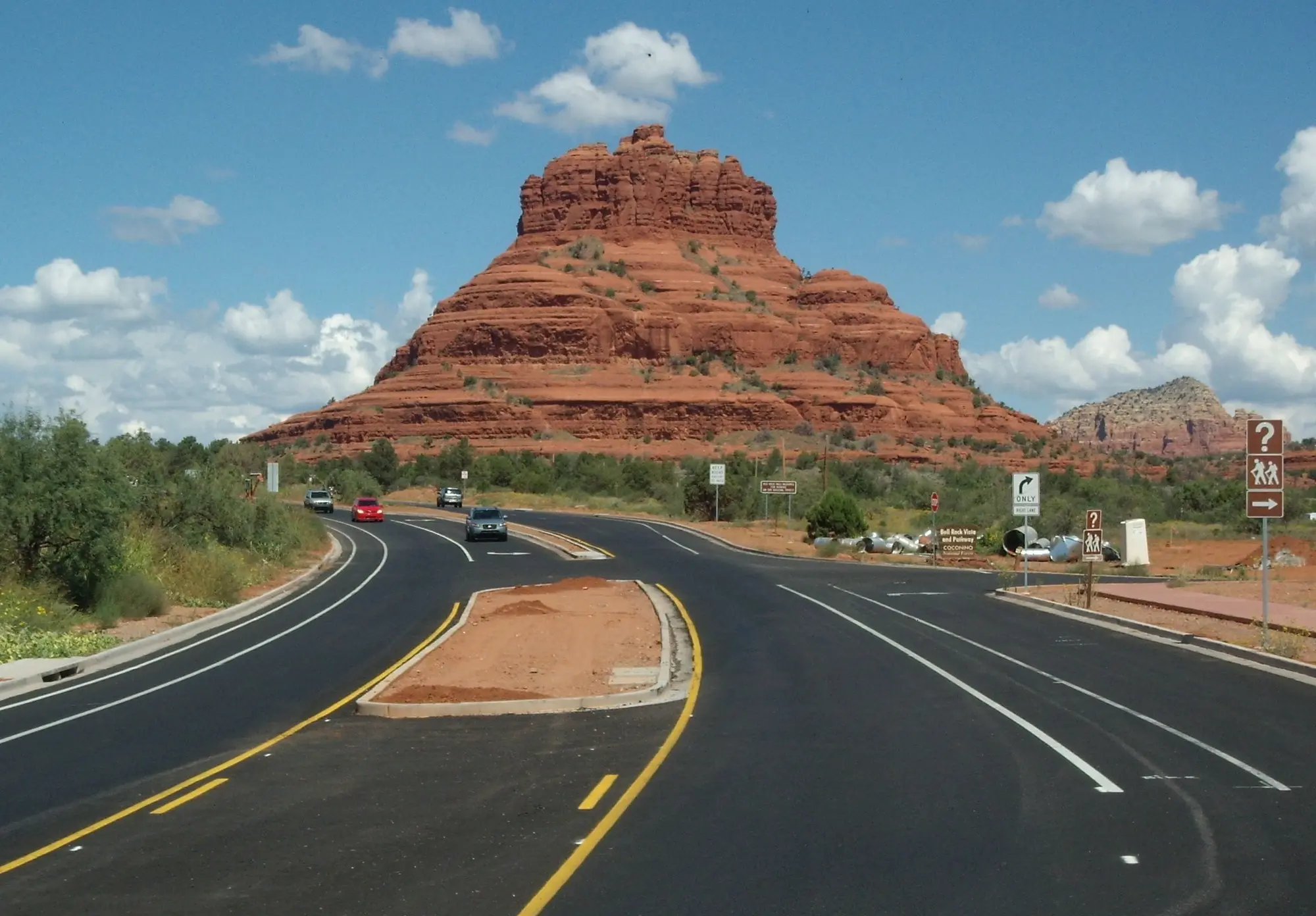
Bell Rock stands beside State Route 179 just north of the Village of Oak Creek, with Courthouse Butte to the east of it. Come up from Phoenix on I-17, and SR 179 runs right past them: the Bell Rock Pathway’s southern trailhead is 8.3 miles from exit 298, through the Village, and about 115 miles, some 2 hours 10 minutes without traffic, from Sky Harbor’s Terminal 4.
Two Forest Service trails take you to the rocks. The Bell Rock Pathway, wide and easy, runs beside the highway past Bell Rock, Baby Bell Rock and Courthouse Butte. The Courthouse Butte Loop leaves it to circle both rocks. Three Forest lots on the highway serve them, and each needs a pass. Below are the two walks, the three trailheads and which to park at, the pass, the free shuttle to the north end, and the guided ways to see Bell Rock.
On 18 November 2026 the Forest’s flood alert for the Red Rock Ranger District, last updated 13 November, listed 21 recreation sites affected by the floods of early November, among them the West Fork, Crescent Moon (Red Rock Crossing) and the Oak Creek Canyon scenic drive. Neither the Bell Rock Pathway, the Courthouse Butte loop nor Courthouse Vista was on it, and Courthouse Vista’s own page read “Site Open” that morning. That makes the Bell Rock trails a good red-rock walk to plan this winter. What the floods closed, and anything that changes, is on our flood closures page.
The pathway or the loop?
| Bell Rock Pathway | Courthouse Butte Loop | |
|---|---|---|
| Forest trail number | 96 | 135 |
| Length | 3.5 miles one way | 3.8 miles round trip on its trail page; 4.3 miles in the Forest’s trail guide |
| Elevation change | 185 feet | 297 feet on its trail page; 350 feet cumulative in the guide |
| The Forest’s grade | Easy, family-friendly | Moderate on its trail page; easy in the guide |
| Time | 2.5 hours round trip | 2.5 hours |
| Underfoot | Mostly wide and hard, with some steep hills; rocky and rough in places around Bell Rock | A narrower trail beyond the pathway, over bare rock and through a dry wash |
| Bicycles | Mountain bikers use it a lot | Prohibited on its wilderness stretch |
For an easy walk with children, or a first close look at Bell Rock, take the pathway: walk south from Courthouse Vista or north from Bell Rock Vista as far as you like, and turn back. For a half day around both rocks, take the loop, outside the summer heat.
The Bell Rock Pathway
The pathway parallels SR 179 for 3.5 miles one way. The Forest calls it a very popular main trail, heavily used by visitors heading for other trails or simply for the views of Bell Rock, Baby Bell Rock, Courthouse Butte and the landmarks around them. Most of it has a wide, hard surface, but there are some steep hills too, and some places around Bell Rock are rocky and rough. The Forest rates it an easy, family-friendly trail, with 185 feet of elevation change from a trailhead elevation of 4,192 feet, and gives 2.5 hours for the round trip.
Mountain bikers use the pathway quite a bit, so keep an eye out for them. Where an e-bike may ride around Sedona is on our e-bike tours and rentals page.
On horses, two of the Forest’s own pages disagree. The pathway’s page, last updated on 30 July 2025, says horses are allowed on the trail and that there is a designated parking space for horse trailers at the trailhead. The Courthouse Butte loop’s page, last updated five days earlier, on 25 July 2025, says “Horses are prohibited on Bell Rock Pathway”, and so does the Forest’s printed trail guide for the loop. The pathway’s page is the newer; before you bring a horse, ask the Forest’s Red Rock Ranger Visitor Center, at 8375 SR 179, which rule it enforces.
The pathway’s page puts restrooms at the northern and southern trailhead lots, and Courthouse Vista, between them, has accessible vault toilets of its own. There is no drinking water at Courthouse Vista, so bring your own.
Courthouse Vista is also, in the Forest’s words, “the trailhead for Courthouse Butte Loop, Bell Rock, and Bell Rock Pathway trails”, which lead on to the Llama, Templeton, HT and Big Park trails nearby. From the lot itself the Forest names the views: Courthouse Butte, Bell Rock, Castle Rock, Lee and Munds mountains, and the red cliffs and canyons along the Mogollon Rim.
The Courthouse Butte loop
Courthouse Butte Loop Trail No. 135 circles Bell Rock and Courthouse Butte together. There are two ways onto it:
- From Bell Rock Vista, the south end: take the wide pathway from the kiosk toward Bell Rock. It climbs gently, and at half a mile a signed intersection marks the loop.
- From Courthouse Vista, on the north side: walk southeast straight toward Bell Rock. At a quarter mile the trail meets the pathway, and you can circle the rocks either way.
Clockwise from the south, the loop climbs gently around the west side of Bell Rock, levels out and curves north below its slopes. Follow the large cairns to the point where the wide pathway turns north and a sign shows the loop branching east. The narrower trail passes north of Courthouse Butte, heading toward Lee Mountain, and crosses the Llama Trail, popular with mountain bikers. It passes a prominent dome-shaped outcrop and descends gradually into the Munds Mountain Wilderness, drops into a dry wash, circles south over bare rock, and climbs out onto level ground as it leaves the wilderness, still circling Courthouse Butte, until it meets the pathway again near Bell Rock. From there, go south for half a mile, the way you came, to the kiosk at Bell Rock Vista; for Courthouse Vista, keep on clockwise around Bell Rock to the trail from the parking area.
The Forest measures the loop two ways. Its trail page, last updated on 25 July 2025, gives 3.8 miles round trip, 297 feet of elevation change and a grade of moderate. Its printed trail guide, “Court House Loop and Big Park Trails”, undated, walks the loop from the Bell Rock Vista kiosk and gives 4.3 miles, 350 feet of cumulative elevation and a grade of easy; its mileposts, from half a mile to the junction to the pathway again at 3¾ miles and half a mile back, add up to that 4.3. Both allow 2.5 hours. Starting from Bell Rock Vista, plan on the longer figure.
The loop is mostly unshaded and can be hot in summer. Bicycles, drones and other mechanized equipment are prohibited by federal law in any wilderness, so a mountain bike can ride the pathway but not the whole loop. The Forest’s guide also asks walkers to respect private property boundaries.
The Big Park Trail, a short offshoot of the loop popular with cyclists, is 1.0 mile round trip: park at Bell Rock Vista, the pathway’s south lot, and take the trail east a short distance to it.
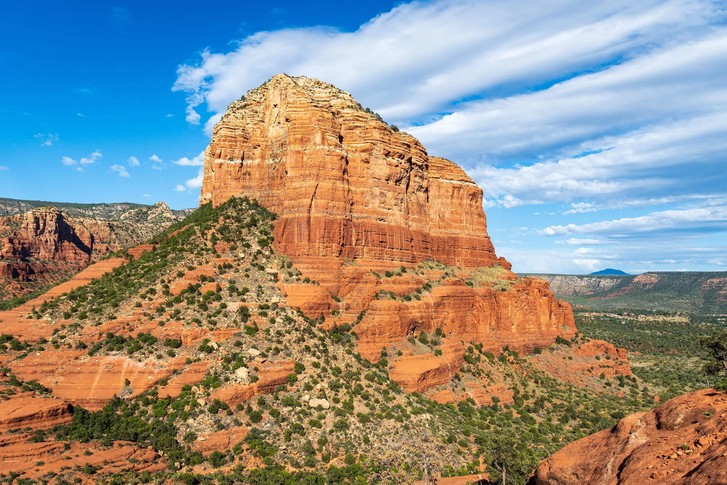
Courthouse Butte, east of Bell Rock, is in the photograph at the end of this page.
The three trailheads, and where to park
All three lots are Forest fee sites on the east side of SR 179: coming from Uptown each is a left turn, and on the way north from the Village of Oak Creek a right. From south to north:
| Trailhead | Where on SR 179 | From Uptown Sedona | From the Village of Oak Creek | At the lot |
|---|---|---|---|---|
| Bell Rock Vista, the pathway’s southern trailhead | Milepost 307.1, south of Bell Rock | 6.5 miles, about 15 minutes | 0.9 mile, about 3 minutes | Restrooms; the kiosk the loop’s trail guide starts from |
| Courthouse Vista, the midway trailhead | Milepost 308.2, just north of Bell Rock, 1.1 miles on | 5.5 miles, about 13 minutes | 2.0 miles, about 5 minutes | Paved parking, accessible vault toilets, a pass machine and an information kiosk; no drinking water |
| Little Horse, the northern trailhead | 1.6 miles north of Courthouse Vista | 4.0 miles, about 9 minutes | - | Restrooms; route 15 of the free shuttle |
Drive times are without traffic. The pathway’s northern trailhead is the Little Horse trailhead: the Forest’s coordinates for it fall at the Little Horse lot, and the shuttle’s Rider Guide lists the Bell Rock Pathway among Little Horse’s trails.
Which to choose: Courthouse Vista for Bell Rock itself and the loop in either direction; Bell Rock Vista for the loop as the Forest’s guide walks it, for the Big Park Trail, and for the shortest drive from the Village; Little Horse if you come on the shuttle, or for the north end of the pathway.
The shuttle does not close Little Horse’s lot, as it does Cathedral Rock’s, but its rules say Little Horse is not to be used as overflow parking for the Cathedral Rock trailhead. Cathedral Rock’s own parking is on our Cathedral Rock page.
The Village of Oak Creek is the nearest place to stay: Bell Rock Vista is under a mile from it. Our where to stay in Sedona guide weighs it against Uptown, West Sedona and Cottonwood.
The free shuttle to Little Horse
Route 15 of the free Sedona Shuttle runs from the North SR 179 Park & Ride, at 1294 SR 179, to Cathedral Rock and Little Horse, Thursday to Sunday and on the extra days of the shuttle’s holiday calendar, though not on Thanksgiving Day or Christmas Day, with no reservation. In its Rider Guide, effective 6 November 2025, buses leave the park and ride every 15 minutes from 7:00 a.m. to 4:30 p.m. and reach Little Horse 16 minutes later, and the last bus back leaves Little Horse at 4:46 p.m., by way of Cathedral Rock. No bus stops at Courthouse Vista or Bell Rock Vista: from Little Horse, walk south on the pathway. The routes, the lots and the calendar are on our getting around Sedona guide.
The Red Rock Pass
Bell Rock Pathway/Vista, Courthouse Vista and the Little Horse trailhead are each on the Forest’s list of sites that need a Red Rock Pass or an America the Beautiful pass to park. As the Forest’s program page gave them on 18 November 2026, the Red Rock Pass costs $5 a day, $15 a week or $20 a year and covers everyone in the vehicle; Courthouse Vista’s own page gives the same prices. The fee machines at the lots sell it. The fee applies when you leave a vehicle at a fee site, so a shuttle rider needs no pass.
Every place to buy one, and the passes that take its place, are in our Red Rock Pass and trailhead parking guide.
Seeing Bell Rock with a guide
Bell Rock is one of the four sites Visit Sedona lists as the town’s main vortexes. Our Sedona vortex tours page covers the vortex sites and compares the guided trips that go to them, and Sedona hiking tours compares the guided hikes.