
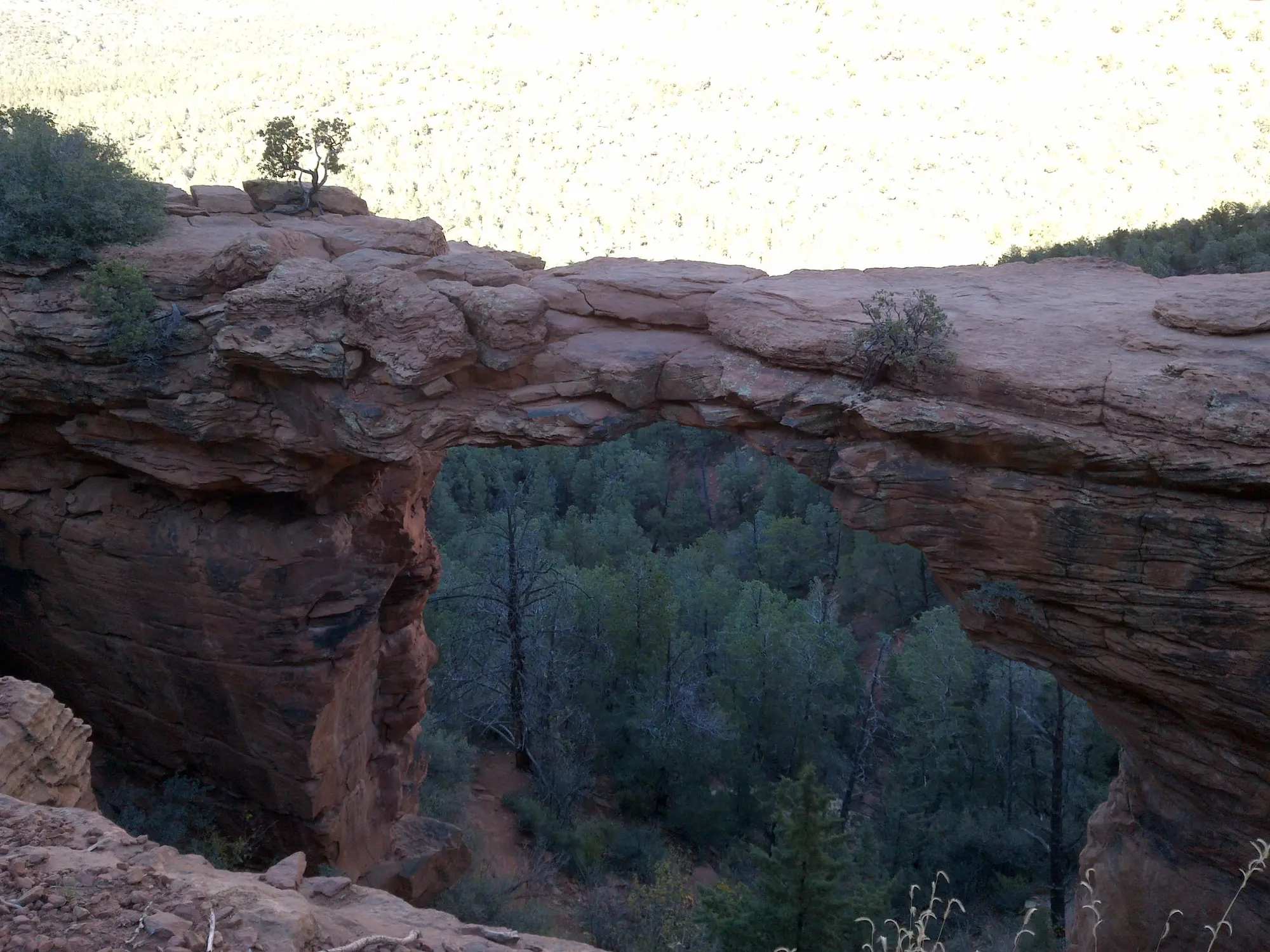

Devil’s Bridge is the largest natural sandstone arch in the Sedona area, a span 50 feet high off Dry Creek Road, north of West Sedona, on the Coconino National Forest’s Red Rock Ranger District. The walk to it is short. Getting a car near enough to start it is the real question: three trailheads lead to the bridge, and the closest is reached only by FR 152, a high-clearance road the Forest listed closed to vehicles on 18 November 2026, so while it is, drivers park at one of the other two. All times on this page are Arizona time, which is Mountain Standard Time all year.
The walk to the arch
From the bridge’s own trailhead, the Forest Service rates the trail moderate: 1.6 miles round trip, 371 feet of climbing from a trailhead at 4,605 feet, and about 2 hours. The first stretch follows an old jeep track, smooth and clear, through washes of juniper and prickly pear cactus, and climbs gently, then more steeply.
About three-quarters of a mile from the parking area, the trail divides:
- Left, to the base. The lower path ends beneath the bridge, where you can stand directly under the 50-foot arch and look straight up.
- Up, to the top. The topside trail climbs a steep natural rock staircase to a wide open area with long views, then another level that leads onto the bridge itself.
The Forest calls the topside trail the biggest treat, and its advice on the bridge is short: if you have the nerve, you can walk across the top, and once you are on it the walk is not hard, but use caution and common sense, because it is a long way down.
Which car reaches which trailhead
Dry Creek Road leaves State Route 89A at the west end of town. Two miles up it, Forest Road 152 forks off to the right and the pavement ends. From that fork, the three ways in:
| Trailhead | How to get there | What it takes | To the bridge and back | Pass |
|---|---|---|---|---|
| Devil’s Bridge trailhead | Take the right fork onto FR 152, the unpaved road, and turn right after about 1.3 miles | A high-clearance vehicle; not recommended in wet weather; listed closed to vehicles on 18 November 2026 | 1.6 miles | Not on the Forest’s list of pass sites |
| Dry Creek Vista | At the end of the pavement, just after the right-hand turn at the fork | Any car | 5.8 miles, by the Chuckwagon Trail | Red Rock Pass or America the Beautiful pass |
| Mescal | Stay on Dry Creek Road to the stop sign at Long Canyon Road, turn right and go 0.2 mile | Any car | 4.0 miles, by the signed Mescal-Chuckwagon connection | Red Rock Pass or America the Beautiful pass |
From Uptown Sedona, Dry Creek Vista is 5.7 miles and about 14 minutes by car (3.4 miles on SR 89A, then 2.2 on Dry Creek Road), and the Mescal trailhead 6.5 miles and about 15 minutes; from West Sedona, Dry Creek Vista is 3.3 miles and about 9 minutes. Those are free-flowing times, before the roundabouts and the hunt for a space.
From Dry Creek Vista, the Chuckwagon Trail adds 2.1 miles each way of moderately easy, rolling trail, about 2.9 miles from the lot to the bridge, and the way to Devil’s Bridge is well marked on the trail signs. Do not walk up FR 152 instead: the Forest calls the unpaved road a popular jeep trail, not recommended for walking.
From Mescal, the Forest sends you by the signed Mescal-Chuckwagon trail connection to the Devil’s Bridge trailhead, 4.0 miles round trip to the bridge. Its page for the Mescal Trail warns that parking there can be limited, especially on weekends. Read the closure below before you start from Mescal.
FR 152, the rough road
The last 1.3 miles to the bridge’s own trailhead are Forest Road 152, the unpaved part of Dry Creek Road. In the Forest’s words: “This road is rough; high-clearance vehicles required. It is not recommended during wet weather.” On 18 November 2026 its road status page, updated that day, listed FR 152, which it names the Vultee Arch OHV Trail, as closed; on that list a road marked Closed “is only closed to motorized vehicles unless otherwise noted,” and it gives no cause and no date for reopening. The Forest’s page for the Devil’s Bridge trail, last updated 22 July 2025, still gives the drive up FR 152 and carries no closure. The road list is the newer of the two, so until it lists FR 152 open again, start from Dry Creek Vista. Where every road and site stands is on Sedona after the floods.
The same road is one of the district’s jeep roads. The jeep tours that drive it are compared on our Sedona jeep tours page, and a two-hour side-by-side rental that goes only to the Vultee Arch and Devil’s Bridge trailheads, on this same road, is on our Sedona ATV and UTV page.
The free shuttle: route 11
The Sedona Shuttle’s route 11 serves both trailheads an ordinary car can reach, Dry Creek Vista (“with access to Devil’s Bridge”, in the shuttle’s own words) and Mescal, from the West SR 89A Park & Ride, 905 Upper Red Rock Loop Road. The lot holds 91 vehicles. Parking there and the ride are both free, no reservation is needed, and shuttle riders pay no parking fee at the trailhead. RVs, campers and buses may not park at the lot, and there is no overnight parking.
The trailhead routes run Thursday to Sunday all year. The shuttle’s holiday calendar changes these dates:
| Dates | The calendar’s entry |
|---|---|
| 19 to 29 November 2026 | Daily, except Thanksgiving Day |
| 26 November 2026, Thanksgiving Day | No service |
| 17 to 24 December 2026 | Daily |
| 25 December 2026, Christmas Day | No service |
| 26 December 2026 to 3 January 2027 | “Service Operates”, in the calendar’s words |
| 25 February to 25 April 2027, spring break | Daily |
The rest of the calendar, and how to reach the Park & Ride without a car, are on our getting around Sedona guide.
Route 11’s timetable, from the shuttle’s Trailhead Shuttle Guide, effective 6 November 2025:
| Trip | First | Then every | Last |
|---|---|---|---|
| Out: leaves the West SR 89A Park & Ride | 7:00 a.m. | 30 minutes | 4:30 p.m. |
| At Dry Creek Vista, then Mescal | 7:10 and 7:15 a.m. | 30 minutes | 4:40 and 4:45 p.m. |
| Back: leaves Dry Creek Vista, by way of Mescal | 7:10 a.m. | 30 minutes | 4:40 p.m., then a last bus at 5:20 p.m. |
| At the Park & Ride | 7:28 a.m. | 30 minutes | 4:58 p.m.; the last bus at 5:30 p.m. |
The last bus takes the loop in reverse: it calls at Mescal first, at 5:15 p.m., then at Dry Creek Vista at 5:20 p.m. From the Dry Creek Vista stop the hike is 5.8 miles round trip, and the Forest allows 2 hours for the 1.6 miles from the bridge’s own trailhead alone: take one of the first buses out, and keep the last one back, at 5:20 p.m., in mind.
The Mescal Trail’s closed crossing
At 6:24 a.m. on 18 November 2026, the Forest Service’s page for the Mescal Trail read “Trail Partially Closed”, and under it: “Mescal Trail at the Dry Creek crossing, just south of the trailhead, is closed due to flooding.” The Forest posts that closure with no date of its own, and the page’s last update, 30 July 2025, is older than the flood. The same morning the Forest’s Devil’s Bridge page, which gives the Chuckwagon route from Dry Creek Vista, carried no closure, and none of the Devil’s Bridge, Chuckwagon or Mescal trails was among the sites on the Forest’s flood alert, last updated 13 November 2026. Where every flood closure around Sedona stands, this one included, is on our Sedona flood closures page.
Passes at the trailheads
Dry Creek Vista, which the Forest’s pass list calls the Dry Creek Trailhead, and Mescal are both fee sites: leave your car there and it needs a Red Rock Pass, $5 a day, $15 a week or $20 a year, or an America the Beautiful pass. The cardholder must be present, and one pass covers everyone in the vehicle. The Devil’s Bridge trailhead on FR 152 is not on the Forest’s list of sites that require a pass, and riding the shuttle you need none. Where to buy one, and which pass suits your trip, are on our Red Rock Pass and trailhead parking guide.
Coming from Flagstaff
The Forest’s directions to Devil’s Bridge still start with “Drive 27 miles south from Flagstaff to Sedona on state Route 89A”, through Oak Creek Canyon. The flood of 1 November 2026 closed that road on the canyon’s switchbacks, and on 11 November the Arizona Department of Transportation gave no estimated time for completion and restricted travel between Sedona and Flagstaff to SR 179 and Interstate 17. That way, from downtown Flagstaff to Uptown Sedona is about 58 miles and an hour and a quarter of free-flowing driving, with Dry Creek Vista 5.7 miles beyond. The road’s current status is on our Sedona flood closures page, and the drive itself on getting to Sedona.


